Balıkesir Metropolitan Municipality Hosts Geographic Data Coordination Meeting
On November 3, the Balıkesir Metropolitan Municipality held a coordination meeting with district municipalities and BASKİ to establish geographic data standards.
6 November 2026, 22:48 · Balıkesir Büyükşehir Belediyesi
This story was automatically translated from the Turkish original.
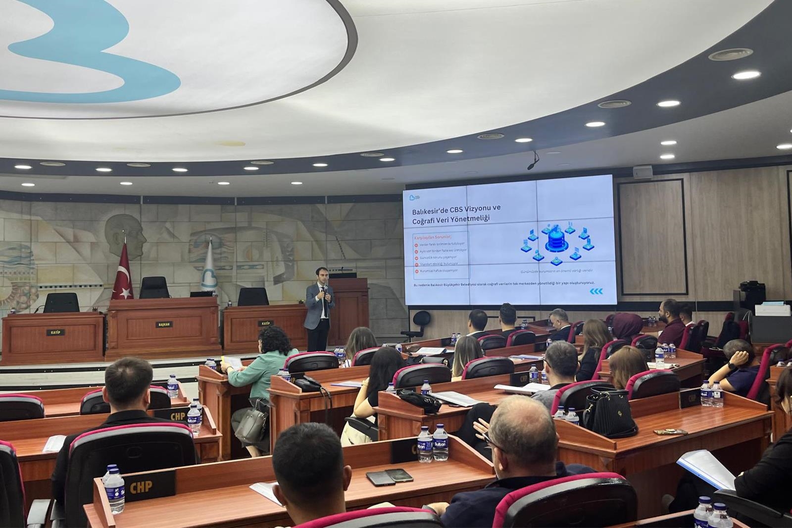
According to an announcement by the Balıkesir Metropolitan Municipality, the first coordination meeting was held on November 3, 2026, at the Council Hall to standardize inter-agency geographic data sharing. Technical staff from units responsible for mapping RTK drones and UAV inventories attended the session.
During a session organized by the Image Processing Working Group, decisions were made regarding data standards, accuracy levels, and shared usage protocols for the maps to be produced. Under the comprehensive management model spearheaded by the Metropolitan Municipality, district municipalities, BASKİ General Directorate, and affiliated entities are also integrated into the process.
The standardized production and updating processes aim to ensure more efficient use of public resources, officials noted. Additionally, plans are underway to strengthen the digital municipal infrastructure and accelerate decision-making mechanisms.